Case Studies
Climatological Spatial Data Mapping Using Machine Learning
Climatological Data is gathered using devices like Radiosonde. This gathered data, given its resolution settings, need not be accurate or complete because of reasons such as an error in the measuring system, temporary failure of the system, and so on. There also might be instances where a different resolution of Data, from the one collected, is required or the Data is not sufficient for some applications. To tackle such problems Machine-Learning algorithms are used.
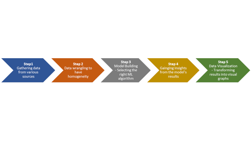
Machine-Learning algorithms such as Support Vector Regression, Random-Forrest, Decision-trees, Recurrent Neural Networks are used for interpolation and prediction of Climatological Data. A generalized Machine-Learning process is shown in the flow-chart below. Such processes are used to fill gaps or to extrapolate the available Data as per one's requirement.
The result that one gets by performing such ML processes on climatological data can be used to get insight into how the atmosphere of the considered region behaves under various circumstances. For instance, one could explain high levels of humidity due to the presence of a water body nearby, or the variation in temperature of a region throughout the day due to the varying solar radiations in the same span of the day. One could also understand the effects of certain atmospheric parameters on long term variations like global warming.
